The east coast of the Saigon River’s section running through Thu Duc City offers great convenience for cultural and urban development
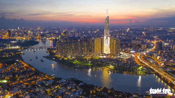
The planned Thu Duc City, with a vast area of land spanning along the Saigon River, is expected to contribute to economic development, improve the quality of life for local people, and promote the meaning of the river if there is a suitable plan on space arrangement for it.
Ho Chi Minh City has been short of greenery spaces for a long time.
Public places such as Dam Sen Park in District 11 and Suoi Tien Theme Park in District 9 mainly serve young people, but they are not suitable for the elderly and other working-class groups.
The downtown spaces have been overloaded, with a majority of them having been covered with high-rise buildings.
Meanwhile, the areas along the Saigon River fit the construction of public projects to expand urban spaces with beautiful landscapes and to connect the downtown area with its neighborhoods.
This planning direction aims to provide open spaces, fresh air, and nature in combination with cultural heritage and in harmony with the diversity of beneficiaries.
|
|
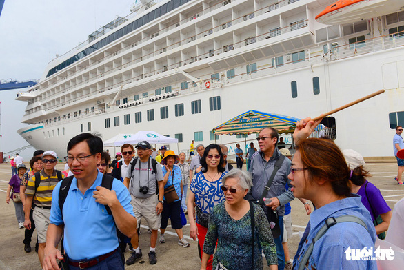
| Passengers on a superyacht arrive in Ho Chi Minh City before the novel coronavirus disease (COVID-19) pandemic. Photo: Quang Dinh / Tuoi Tre |
The east bank of the Saigon River’s section passing through Thu Duc City offers great convenience for easily connecting cultural monuments and sites, pagodas, and churches.
The section not only has beautiful scenery, smooth flow, ideal depth and breadth for ships and boats, but also has a series of cultural places such as pagodas and churches, the Thu Thiem New Urban Area, Me Linh Square, Nguyen Hue Pedestrian Street and Saigon Port, Tan Cang area, Ba Son Shipyard, Nha Rong Wharf, and Bach Dang Wharf.
It will be meaningful to combine preserving historical and cultural relics and leveraging service industries with developing tourism and culture there, instead of merely erecting skyscrapers with no cultural meaning.
This will create an advantage for the Saigon River to become a ‘cultural hallmark’ of Ho Chi Minh City, carrying distinctions of the city and its people — an intangible tourism product that local residents and tourists will enjoy.
|
|
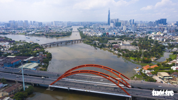
| An aerial view of the Saigon River’s section running through Binh Thanh District in Ho Chi Minh City. Photo: Quang Dinh / Tuoi Tre |
An example of promising tourism products will be sightseeing on pleasure boats, combined with serving local cuisine and traditional Vietnamese music while introducing the local culture at night.
On the other hand, the Saigon River’s section passing through Thu Duc City originally helped to naturally drain water from many routes and alleys in Linh Dong, Hiep Binh Chanh, and Hiep Binh Phuoc Wards in the current Thu Duc District so that these areas were not flooded by heavy rains in the past.
However, the construction of many real estate projects has led to inundation in these areas whenever it rains.
The situation sounds the alarm on reviewing the local planning of property projects along the riverbanks to make necessary adjustments for the sake of local residents. Stricter measures such as putting the brakes on licensing riverside projects should also be considered.
In addition, an international contest on a master scale should be organized to learn from the planning experience and success of big cities in the world such as Hong Kong, Tokyo, Shanghai, London, and New York.
From the models, the most optimal and quality scheme will be chosen to determine specific areas along the Saigon River’s section running through Thu Duc City either for commercial purposes or for building landscapes, parks, and public works for the community.
|
|
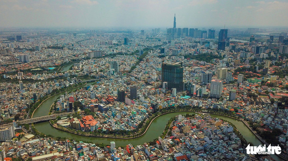
| An aerial view of the Saigon River running through Ho Chi Minh City. Photo: Quang Dinh / Tuoi Tre |
Comment and feedback will also help minimize risks and limit false factors.
Implementers and investors will thus become more confident to carry out the plan while local people will also show support.
The abundant unoccupied land plots outside the safety corridor of the river can be researched for projects. However, the pre-designed planning should only allow constructions with low density and housing areas occupying a small part to ensure the harmonious architecture of the overall picture.
Public projects there, thanks to convenience in advertising, branding, product introduction, and service implementation, are bound to attract investment from enterprises, organizations, and individuals, easing the burden on Ho Chi Minh City’s state budget and contributing to the city’s tax collection if appropriately executed.
In this way, the interests of all parties will be ensured. Local people will be able to enjoy an attractive destination, investors will benefit from their projects, while local authorities will not only have an income but also be able to promote the image of a cultivated city and sustainable development.


